


Local Sponsors
-
-
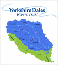
Yorkshire Dales River Trust
Yorkshire Dales Rivers Trust. 8 Kings Court, Pateley Bridge, North Yorkshire, HG3 5JW
Volunteers are invaluable to the YDRT and we are always looking for people to join us in helping to care for our rivers. Would you like to help protect your local environment? Do you enjoy working outside in iconic locations? Would you like to gain practical skills or develop a career in environmental management? Come and volunteer with us. We have many activities that you can get involved for any ability or experience. It’s great fun in a friendly environment.

More information
Many thanks to The Red Lion Hotel for facilitating this camera's location and to The Yorkshire Dales River Trust for capitally funding it's installation.The River Wharfe serves as the county boundary between West Yorkshire and North Yorkshire for a significant stretch. Its name, Wharfe, has Celtic origins and signifies a twisting and winding nature. The river flows through a valley known as Wharfedale, beginning at Beckermonds in Langstrothdale within the Yorkshire Dales National Park. It passes through notable locations such as Kettlewell, Grassington, Bolton Abbey, Addingham, Ilkley, Burley-in-Wharfedale, Otley, Wetherby, and Tadcaster before eventually joining the River Ouse near Cawood. The upper section of the river, from its source to around Addingham, is referred to as Upper Wharfedale and possesses distinct characteristics compared to the downstream stretch.
A notable feature along the river is a five-arched bridge that the Dalesway trail traverses. This bridge is located within the Yorkshire Dales National Park, approximately 2 miles (3.2 km) southeast of Hebden, and it follows a river path with roots dating back to Viking times.Moving on to the history of Burnsall Village, the Domesday Book mentions that "in Brineshale, Dringlet had two carucates and two oxgangs to be taxed," and historical records indicate that the area suffered devastation during the rebellion of the Anglians and subsequent Norman conquest. While limited history is documented beyond the 11th century, the possession of Skipton by Robert de Romille marks an important period. Numerous relics from this time can still be seen in the church of St Wilfrid, with the oldest section dating back to the 12th century and later additions from the 14th century. The Norman ornamentation on the base of the front suggests a period no later than 1150. Records from the 13th century attest to the church's existence, and a stone tablet commemorates the repair and embellishment of the church by Sir William Craven, the inspiration for the tale of 'Dick Whittington' and a former Lord Mayor of London. Adjacent to the church, the old Grammar School, founded by Sir William Craven, now serves as the local primary school.The Red Lion, a longstanding establishment, has been offering hospitality for centuries. Its cellars, believed to be inhabited by a mischievous ghost, date back to the 12th century, while the current bar area was originally a "one up, one down" structure from the 16th century. Over the years, The Red Lion has undergone gradual expansions to become the charming building it is today, featuring beamed ceilings, sloping floors, and an abundance of character. The inn remained within the same family ownership until 2021 when it became part of the Daniel Thwaites family.The Farson webcam is strategically placed on the River Wharfe at The Red Lion Hotel in Burnsall. Its purpose is to monitor river levels for fishing activities, recreational users of the river, and the potential risk of flooding.