
Local Sponsors
-
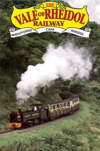
Vale of Rheidol Railway
Park Avenue, Aberystwyth, Ceredigion, SY23 1PG
The Vale of Rheidol Railway re-creates the Edwardian spirit of adventure. Step aboard one of our restored steam trains for a stunning journey along the Rheidol Valley. Since opening in 1902, millions have enjoyed the scenic trip through the ancient woodlands to Devil’s Bridge, home of the famous waterfalls nestled in the astounding Cambrian Mountains. See the countryside change as you travel through wide open fields and meadows, woodland and rugged mountain scenery. The narrow track gauge allows the railway to follow the contours of the terrain with many sharp curves and steep gradients which add to the railway’s charm. Listen to the sound of a powerful narrow gauge steam locomotive working hard to climb 700ft (200m) during the 12 miles from Aberystwyth to Devil’s Bridge. Birds of prey such as Red Kite and Buzzards are regularly seen soaring high above the valley floor and breath taking views can be enjoyed by all.
-
Aberystwyth University
Aberystwyth, Ceredigion. SY23 3FL
Since 1872, we have built a global reputation for teaching excellence and ground-breaking research. Today, we are home to students from all over the world. We pride ourselves on our welcome and inclusivity, while at the same time being a university rooted in excellence and research. As the first University College in Wales, Aberystwyth has a long and distinguished tradition of teaching and research, and our establishment in the 19th century is one of the great stories of pioneering achievement in modern Welsh history. Research and innovation are the lifeblood of Aberystwyth University. They deepen our knowledge and understanding, inform our teaching and enhance your learning experience, and deliver real benefits to everyday lives in Wales and the wider world. For Aberystwyth University, research really matters.