


Local Sponsors
-
The Bridge Inn in Grinton
The Bridge Inn Grinton, Reeth DL11 6HH
Traditional dog friendly village pub in the heart of the Yorkshire Dales. letting rooms and pub grub...
-
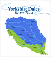
Yorkshire Dales River Trust
Yorkshire Dales Rivers Trust. 8 Kings Court, Pateley Bridge, North Yorkshire, HG3 5JW
Volunteers are invaluable to the YDRT and we are always looking for people to join us in helping to care for our rivers. Would you like to help protect your local environment? Do you enjoy working outside in iconic locations? Would you like to gain practical skills or develop a career in environmental management? Come and volunteer with us. We have many activities that you can get involved for any ability or experience. It’s great fun in a friendly environment.

More information
Many thanks to Valerie Taylor for facilitating this camera's location and to The Yorkshire Dales River Trust for capitally funding it's installation. The River Swale, a significant tributary of the River Ure, ultimately flowing into the North Sea through the Humber Estuary, lends its name to Swaledale, the encompassing valley. This river and its valley harbor a diverse array of plant and animal species indigenous to the Yorkshire Dales region. Exhibiting characteristics of both river and glacial erosion, the River Swale meanders through various rock formations. Throughout history, the river has played a pivotal role in the establishment of settlements, offering a vital water source for agriculture and livestock rearing. Moreover, it has been intertwined with mining operations, dating back to Roman times and even earlier. Renowned as England's swiftest flowing river, the water levels of the River Swale have been known to surge by 10 feet within a mere 20 minutes. The annual precipitation averages 1800 mm p.a. in the upper reaches and 1300 mm p.a. in the lower regions, spanning a vertical descent of 148 m across a distance of 32 km.Archaeological evidence reveals human occupation in the river valley dating back to the Mesolithic and Neolithic Ages, with discoveries of flint tools and arrowheads. In the vicinity of Harkerside, remnants of small stone circles from the Bronze Age and defensive earthworks from the Iron Age can be found. Lead mining traces its roots back to Roman times, evidenced by findings at the Hurst mine. Although this industry experienced a decline, it resurged following Norse invasions in the area. During the extensive ecclesiastical construction of the 12th and 13th centuries, lead emerged as a valuable commodity, leading to increased mining activities in the valley. Remnants of this mining history can still be observed, such as the remains of 18th-century "hushing" practices, which involved constructing turf dams across gills and subsequently releasing them to wash away topsoil, thereby exposing the ore veins.In ancient times, the River Swale played a role in the Votadini Celtic kingdom of Catraeth. However, in the late 6th century, the river valley was invaded by the Angles, who captured the settlement at Catraeth (now Catterick). Efforts by warriors from the Celtic Gododdin kingdom to the north to dislodge the Angles were unsuccessful, as seen in the Battle of Catraeth. Subsequently, the Angles established their presence at Reeth, Stainton, Grinton Bridge, and Fremington. By the mid-9th century, Norse settlers had invaded both the lower and upper regions of the valley. After the Norman conquest, the lands in the valley were granted to Alan the Red of Brittany, who constructed Richmond Castle between 1071 and 1091. Perched on a bluff overlooking the River Swale, the castle became a prominent landmark.Legend has it that in the 7th century, St. Paulinus performed mass baptisms in the River Swale at Brompton-on-Swale and downstream at Brafferton. Due to the significant number of people baptized in this manner, 19th-century writers likened the Swale to England's River Jordan. Presently, mass baptisms continue to take place in the river around the Catterick Bridge vicinity.