Many thanks to
The Riverside Hotel for facilitating this camera's location and to
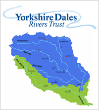
Tadcaster Flood Action Group for capitally funding it's installation. The River Wharfe originates within the Yorkshire Dales National Park and serves as the county boundary between West Yorkshire and North Yorkshire for a significant portion of its middle course. Its picturesque valley is known as Wharfedale. The watercourse assumes the name River Wharfe at the point where Greenfield Beck and Oughtershaw Beck merge, specifically at Beckermonds. It then flows through Langstrothdale, passing near or through notable locations such as Kettlewell, Grassington, Bolton Abbey, Addingham, Ilkley, Burley-in-Wharfedale, Otley, Wetherby, and Tadcaster before ultimately joining the River Ouse near Cawood. The upper section of the river, stretching from its source to approximately Addingham, is situated in Upper Wharfedale and exhibits a distinct character from the downstream portion.With a length of 65 miles, the Wharfe ranks as the 21st longest river in Britain before it converges with the Ouse. It is navigable to the public from the Tadcaster weir to its confluence with the Ouse near Cawood, and the tidal influence extends from Ulleskelf to the Ouse.The name "Wharfe" can be traced back to the Roman era, having been recorded as "Verbeiae" on a Roman inscription discovered in Ilkley. The inscription was dedicated to "Verbeia," believed to be the protective goddess associated with the river. The name likely originates from a Brythonic root denoting "winding" and later evolved under the influence of the Old Norse term "hwerfi," meaning "bend."Remnants of Iron Age fields and hut circles are still visible on the hills above Grassington and Kettlewell, indicating early human settlements in the region. The Romans constructed a road through Wharfedale that traversed Stake Moss into the neighboring Wensleydale. The local British tribe of Brigantes was subdued by the Romans in AD 74, and lead mining operations were conducted by the Romans on Greenhow Hill overlooking Appletreewick until AD 410. Following this period, the Romano-Britons were joined by Angles, who further cleared forests and established agricultural fields for crops and livestock. Initially, the area experienced Danish invasions, but eventually, the Danes settled and engaged in farming near Burnsall and Thorpe. The Viking influence became prominent in the 10th century, as evidenced by the names of hamlets and landscape features in Upper Wharfedale. During the Anglo-Saxon era, large estates were established, and Earl Edwin of Bolton-in-Craven provided protection to the River Wharfe and its valley. Subsequent to the Norman invasion, the lands were granted to Robert Romilly.In medieval times, agricultural practices were characterized by low-intensity methods utilized for both crop cultivation and livestock rearing. Notably, the prominent monasteries of Fountains, Rievaulx, and Bolton Priory maintained extensive sheep flocks and participated in the European wool trade. In 1155, Alice de Romilly donated land for the establishment of Bolton Priory and also provided land at Kilnsey to Fountains Abbey. The monasteries played a crucial role in the development of large-scale sheep farming and the creation of drove roads, which can still be observed and traversed today. The success of the monasteries also contributed to the growth of market towns such as Grassington and Kettlewell.Following the dissolution of the monasteries in 1539 and subsequent decline in wool prices, many tenant farmers transitioned to cattle and sheep rearing. However, small-scale arable production persisted until the end of the 17th century. As industrial towns began to flourish in the early 19th century, the demand for food prompted farmers to focus on milk production in the lower lands while utilizing the higher fells for sheep farming.On July 5, 2014, Stage 1 of the Tour de France, from Leeds to Harrogate, traversed Wharfedale along roads in close proximity to the river. The route in Wharfedale commenced near the official start at Harewood and concluded just after Buckden when the competitors ascended Kidstones Pass near Cray.The River Wharfe and its surrounding valley have served as captivating settings for various films. Grassington, in 1992, featured as a filming location for Wuthering Heights. The 2003 film Calendar Girls utilized several locations in the river valley, including Ilkley Moor, Buckden, Burnsall, Kettlewell, and Kilnsey.Ilkley, a spa town and civil parish in West Yorkshire, lies approximately 12 miles north of Bradford and 17 miles northwest of Leeds. Situated mainly on the south bank of the River Wharfe in Wharfedale, within the Yorkshire Dales, it was historically part of the West Riding of Yorkshire. The civil parish of Ilkley includes theadjacent village of Ben Rhydding and falls under the jurisdiction of the City of Bradford Metropolitan District Council. Tourism plays a significant role in the local economy due to Ilkley's spa town heritage and the picturesque surrounding countryside. The town center boasts Victorian architecture, wide streets, and vibrant floral displays. To the south of the town lies Ilkley Moor, which is the subject of a well-known folk song often considered the unofficial anthem of Yorkshire, titled "On Ilkla Moor Baht 'at." The lyrics of the song are written in Yorkshire dialect and the title translates to "On Ilkley Moor without a hat."