Many thanks to
Commercial Street MOT Service Centre for facilitating this camera's location and to
Tadcaster Flood Action Group for capitally funding it's installation. The current bridge, known as Tadcaster Bridge or Wharfe Bridge, has a historical origin tracing back to the early 1700s. According to Pevsner, it was constructed using stone sourced from the remnants of the ruined Castle. During the 19th century, the bridge underwent a widening process. It serves as a vital transportation route, connecting the town center, which is divided by the river, and stands as one of the two road crossings in the town, the other being the A64 bypass bridge.Unfortunately, on December 29, 2015, the bridge experienced a partial collapse due to flooding. This incident resulted in the rupture of a gas main, necessitating the evacuation of numerous residents and creating a division within the town. In early 2016, Historic England conducted an assessment to evaluate the significance of the Grade-II listed bridge, which served as the basis for its subsequent restoration. The bridge underwent repairs and widening, finally reopening to traffic on February 3, 2017.Regrettably, the vicinity surrounding the bridge, including the northern end of the High Street, Wharfe Terrace houses, the Bus Station, and the Tadcaster Medical Centre, encountered flooding once again in February 2022. To monitor water levels, high tides, and the potential for flooding, a Farson streaming webcam has been strategically positioned.Tadcaster Bridge, also known as Wharfe Bridge, stretches across the River Wharfe in the town of Tadcaster. Believed to have been constructed around 1700, this road bridge plays a central role in connecting the two sides of the town and serves as one of the two road crossings within the area, the other being the bridge for the A64 bypass. The partial collapse of Tadcaster Bridge occurred on December 29, 2015, following the flooding caused by Storm Eva.
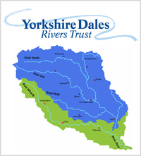
The River Wharfe, for a significant portion of its course, acts as the boundary between West Yorkshire and North Yorkshire. Its name derives from the Old English word "weorf" or the Old Norse word "hverfr," both meaning a winding river. The valley through which it flows is renowned as Wharfedale. Originating from Beckermonds in Langstrothdale within the Yorkshire Dales National Park, the river passes through various locations, including Kettlewell, Grassington, Bolton Abbey, Addingham, Ilkley, Burley-in-Wharfedale, Otley, Wetherby, and Tadcaster, before merging with the River Ouse near Cawood. Notably, the section of the river from its source to approximately Addingham falls within Upper Wharfedale and possesses distinct characteristics compared to the downstream portion of the river.