Ryther Fleet - B1223

View archive gallery
Square tr
Square tr
Square tr
Square tr
Square tr

Local Sponsors

More information

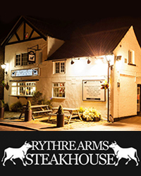
Many thanks to The Rythre Arms Steakhouse  for facilitating this camera's location, and to Ryther-cum-Ossendyke Parish Council, its Flood Action Group, and North Yorkshire Council for capitally funding its installation.This live camera monitors the B1223 at Ryther, beside the Fleet, a local watercourse which drains into the nearby River Wharfe. Its position provides a particularly useful view of local road and water conditions in a village that has always lived with the risk of flooding.Ryther lies approximately midway between Tadcaster and Selby, on the south bank of the River Wharfe. The village occupies very low-lying ground, generally only around 8 to 10 metres above sea level, within the Humberhead Levels. At this point the Wharfe is tidal and joins the River Ouse only around 3 km downstream. Ryther and Ossendyke Ings form part of the surrounding floodplain, and the combined influence of the Wharfe, the Ouse, local drainage channels and heavy rainfall has made flooding a recurring feature of life here.At the eastern end of the village stands All Saints’ Church, parts of which date from the 13th century. Close beside it once stood Ryther Castle, the principal seat of the de Ryther family from the Middle Ages until the 16th century. The de Rythers were an important Yorkshire family with a strong military tradition, and members of the family took part in the campaigns of the medieval English kings, including the Battle of Falkirk in 1298 and the Siege of Caerlaverock in 1300.The former castle site has also produced one of Ryther’s more mysterious discoveries. In 1841, substantial foundation stones were uncovered at Hall Garth together with the remains of eleven human skeletons reportedly laid in the form of a ring. Their date and identity were never established, leaving a rather darker and still unexplained chapter in the history of the village. Historic England’s archaeological record continues to document the find.Another remarkable discovery was made near Ryther in 1992, when a metal detectorist uncovered what became known as the Ryther Hoard. It consisted of 817 medieval silver coins, many of them minted in York, dating from around 1487 — the very beginning of the Tudor period and only a couple of years after the end of the Wars of the Roses. The hoard is now part of the Yorkshire Museum’s collection.The River Wharfe itself rises in the Yorkshire Dales and flows through places including Grassington, Ilkley, Otley, Wetherby and Tadcaster before passing Ryther and joining the Ouse near Cawood. By the time it reaches Ryther it is a broad lowland river influenced by tides from the Humber system, very different in character from its upper reaches in the Dales.That combination of a tidal river, extremely low-lying land and a long history of flooding makes this camera particularly valuable. It provides a direct view of conditions beside the B1223 and the Fleet during periods of heavy rainfall, rising river levels and local flooding, while also overlooking a landscape whose relationship with the River Wharfe has shaped Ryther for many centuries.